Visual Image
Last updated: Nov. 30, 2022
Overview
The visual format converts the source imagery to an 8-bit range suitable for visual display.
Images from multiband sensors (Worldview 2, 3, and 4) are:
- Orthorectified
- Pansharpened using panchromatic and multiband images
- Red-Green-Blue bands only
- Radiometrically balanced per tile
- Dynamic range adjusted to 8-bits per band (RGB)
- Resampled to 0.30517578125m pixel size and aligned to the ARD grid
Images acquired by Worldview 1 are only panchromatic so they are:
- Radiometrically balanced per tile
- Dynamic range adjusted to 8-bit (greyscale)
- Resampled to 0.30517578125m pixel size and aligned to the ARD grid
Files are delivered as Cloud Optimized GeoTIFF (COG):
- processed using GDAL's
COGoutput format using default settings - RGB images use
JPEGYCbCr compression - Panchromatic images use
DEFLATEcompression - NoData pixels are encoded in a mask band
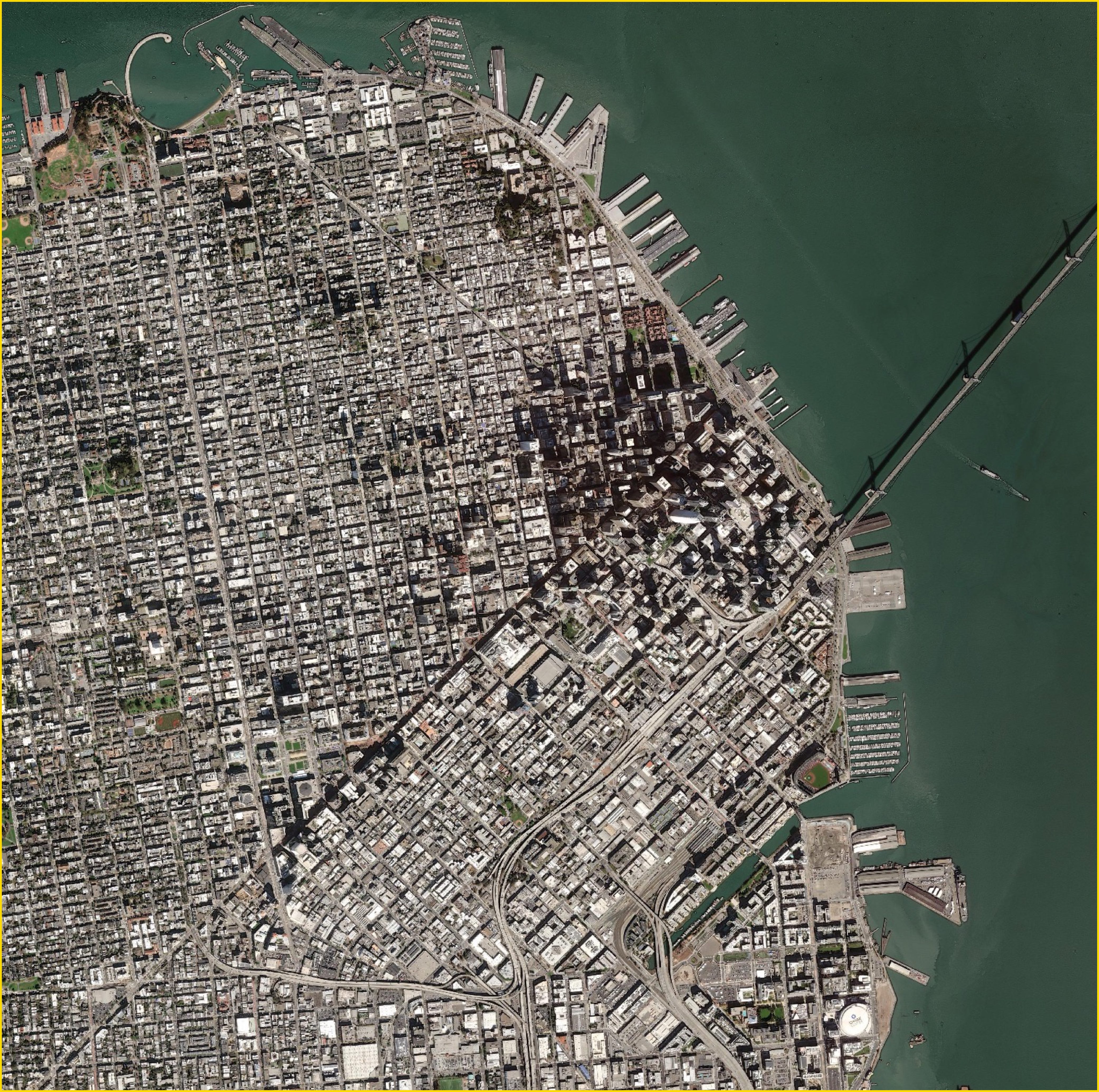
Example image
This example shows a "visual" pan-sharpened image over San Francisco, CA USA.
Bands
Visual RGB imagery has the following three bands:
| band name | common name | description |
|---|---|---|
| BAND_R | red | Red |
| BAND_G | green | Green |
| BAND_B | blue | Blue |
Panchromatic visual imagery has one band:
| band name | description |
|---|---|
| BAND_P_V | Pan Visual |
File information
File type: Raster GeoTIFF
File name: {acquisitionID}-visual.tif
File path: bucket or location/prefix/UTM zone/quadkey/acquisition date/