Terrain Shadow Mask
Last updated: October 7, 2021
Example imagery
This example shows a multispectral WorldView-2 image, taken over Mt. Fuji, Japan. The image on the left shows the ARD image. The image on the right shows the detected terrain shadows.
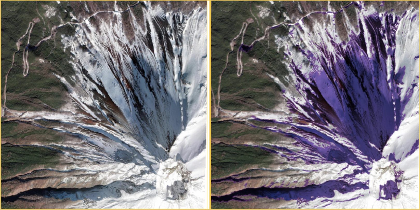
Sample Terrain Shadow Mask: Left: RGB image of Mount Fuji. Right: terrain shadow mask. Purple indicates shadows cast from higher topography.
Overview
The Terrain Shadow mask looks at the position of the sun relative to topography, and predicts locations covered by shadow. Terrain shadows are detected in the multispectral imagery at native resolution as collected by the satellite.
An ARD order delivery includes a raster GeoTIFF mask and a vector GeoPackage mask. The vector mask is derived from the raster mask.
| Mask title | File name | File type | Description |
|---|---|---|---|
| Terrain Shadow Mask | {acquisitionID}-terrain-shadows.tif | Raster | Detected pixels for cloud shadows. |
| Terrain Shadow Polygons | {acquisitionID}-terrain-shadow-mask.gpkg | Vector | Detected boundaries of cloud shadows. |
How to read the mask data
The Terrain Shadow mask is binary with 1 (True) indicating the presence of terrain shadows and 0 (False) indicating no terrain shadows detected.
Pixels predicted to be blocked from direct sun illumination are captured within the mask. For a given location, such as Mt. Fuji shown above, the masked pixels will vary by time of year which influences sun elevation and sun azimuth.
Classification/Detection
Terrain shadows are detected through a variety of techniques starting from ray tracing on a coarse digital elevation model (DEM) and the specific viewing and illumination angles of each image. These shadows are refined using spectral and spatial information from the multispectral imagery.
Use case examples
Shadowed locations do not allow accurate capture of surface reflectance. This mask allows users performing data analyses that require accurate surface reflectance readings to easily identify and eliminate terrain shadow pixels. AI and other feature identification analyses can be carried out with terrain shadows excluded.
Known issues
In some cases, the terrain shadow algorithm may not detect very small shadows. It could potentially classify water or cloud shadow as terrain shadow if there is also an elevation change.