Clouds and Cloud Shadow Coverage
Last updated: October 7, 2021
Example imagery
This example shows a visual (RGB) 30cm WorldView-3 image taken over Cairo, Egypt in June 2015. The image on the left is the ARD tile. The image on the right shows the cloud boundaries detected by the algorithm.
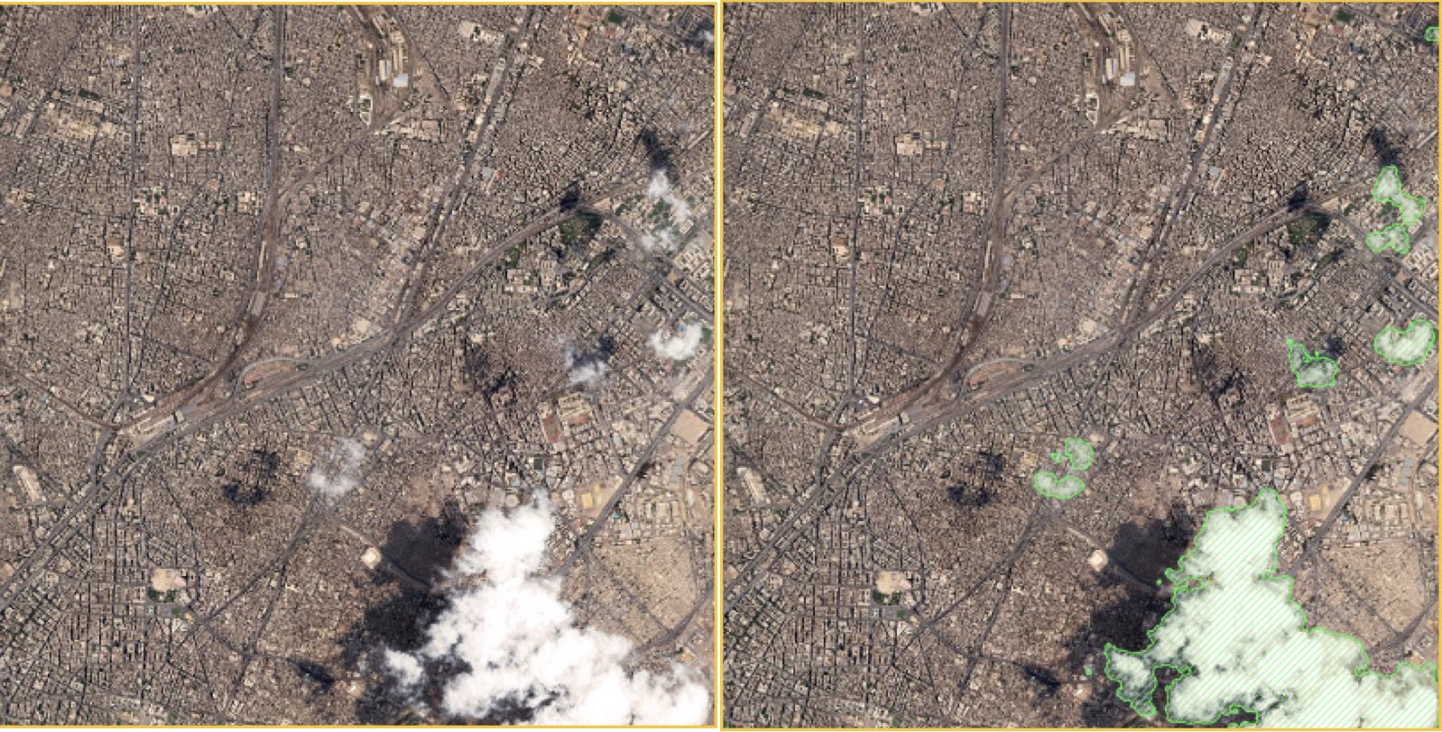
Left: Analysis-ready visual image with clouds. Right: Shows boundaries of detected clouds, outlined in green.
Cloud Shadows Mask example
This example shows the ARD tile on the left. The image on the right shows the cloud shadows detected by the algorithm.
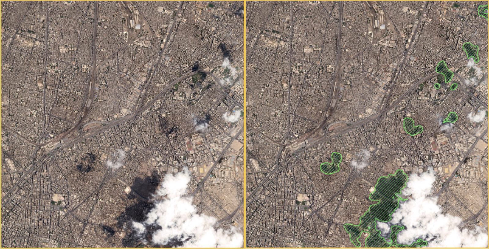
Left: Analysis-ready visual image with clouds. Right: Detected cloud shadows. Green pixels indicate cloud shadows.
Overview
Clouds and cloud shadows obscure valid data when viewing or analyzing satellite imagery. The Maxar ARD cloud masks use a deep learning algorithm with data from an extensive labeling campaign to identify clouds and cloud shadows. These masks are derived from an ARD visual image, which has been atmospherically corrected and undergone dynamic range adjustment. The masks trace the detected boundaries of clouds and cloud shadow pixels, and differentiate them from clear or invalid pixels.
An ARD order delivery includes a raster mask that identifies clouds and cloud shadows and two vector masks that identify clouds and cloud shadows separately. The vector masks are derived from the raster mask.
| Mask title | File name | File type | Description |
|---|---|---|---|
| Cloud/Cloud Shadow Coverage raster | {acquisitionID}_clouds.tif | Raster GeoTiff | Detected pixels for clouds and cloud shadows. |
| Cloud Mask | {acquisitionID}_cloud-mask.gpkg | Vector | Clouds polygons that indicate the detected boundaries of clouds. |
| Cloud Shadows Mask | {acquisitionID}_cloud-shadow-mask.gpkg | Vector | Cloud polygons that indicate the detected boundaries of cloud shadows. |
How to read the mask data
The cloud mask is a set of multipolygons. Pixels that intersect or are contained within the mask are predicted to be obscured by clouds or cloud shadows. The cloud mask raster identifies pixels and assigns the following values:
| Pixel value | Definition |
|---|---|
| 0 | no data |
| 1 | clear |
| 2 | cloud |
| 3 | cloud shadow |
Use cases
The cloud masks provide a simple way to distinguish cloudy pixels and cloud shadows from ground pixels of interest. Eliminating cloudy pixels from consideration can help to reduce false detections and omissions in AI applications, such as change detection and building identification.
Known issues
In rare cases, cloud detection may misclassify very dark clouds.
Cloud shadow detection may misclassify shadows over dark ocean or coastal water, shadows associated with dense haze, or shadows near the boundary of the tile.